About the Project
The Morgan Offshore Wind Project and the Morecambe Offshore Windfarm are two proposed offshore wind farms being developed in the Irish Sea.
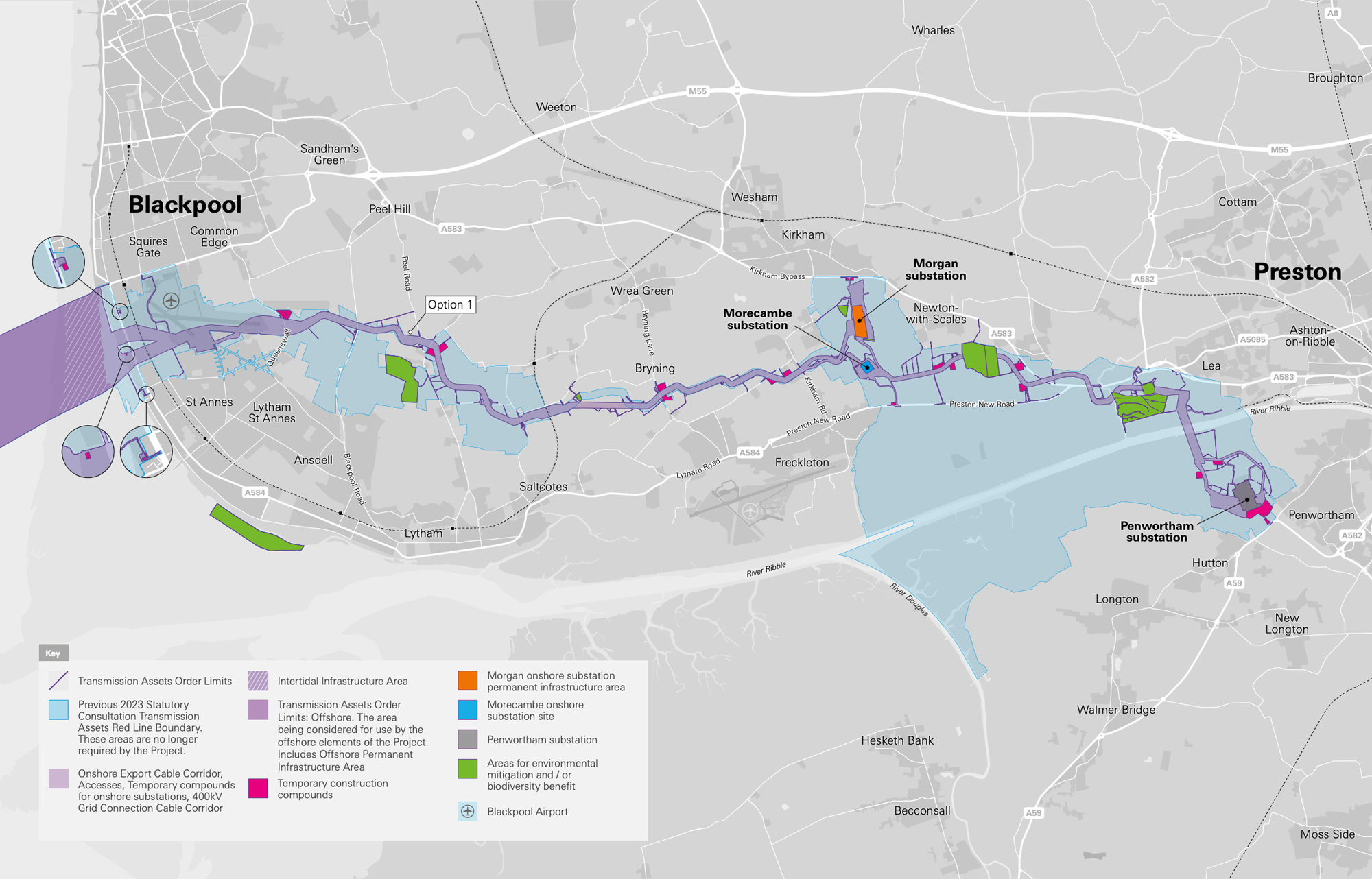
The offshore wind farms are collaborating to connect to the national grid via the Morgan and Morecambe Offshore Wind Farms: Transmission Assets project (referred to as "the Project").
The Project will comprise both permanent and temporary infrastructure including, but not limited to:
- Offshore infrastructure including offshore export cables, offshore substation platform(s), interconnector cables and a Morgan offshore booster station.
- Landfall works (where the offshore cables reach the shore) between Mean Low Water Springs and the transition joint bays including the offshore and onshore cables, intertidal working area and landfall construction compound(s), and temporary and permanent access.
- Onshore infrastructure from the transition joint bays to the electricity transmission network connection. This includes onshore export cables to the two new substations, temporary construction compounds, temporary and permanent access, and onward connections to the existing National Grid substation at Penwortham, Lancashire.
- Areas for biodiversity net gain, enhancement and / or mitigation, including permanent access for operation and maintenance of those areas.
The two offshore wind farms are expected to make a key contribution to the UK’s target of generating 50GW of power from offshore wind by 2030. Combined they have the potential to generate almost 2GW of electricity – enough to power the equivalent of around two million homes.
Click image to enlarge
Pinch to zoom